Detailed Topographical Maps of Macedonia And Surrounds
Below are very detailed topographial maps of Macedonia and the surrounding regions.
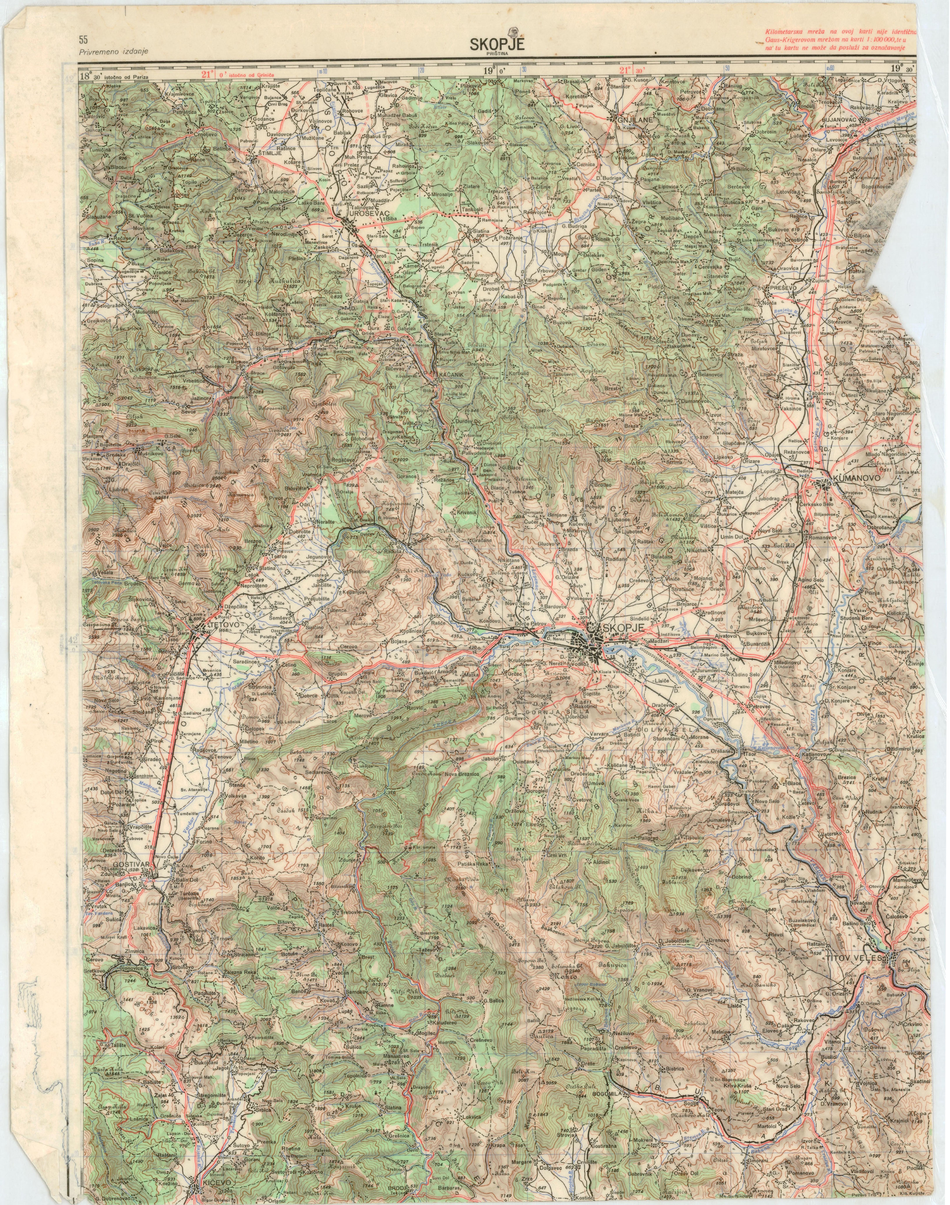
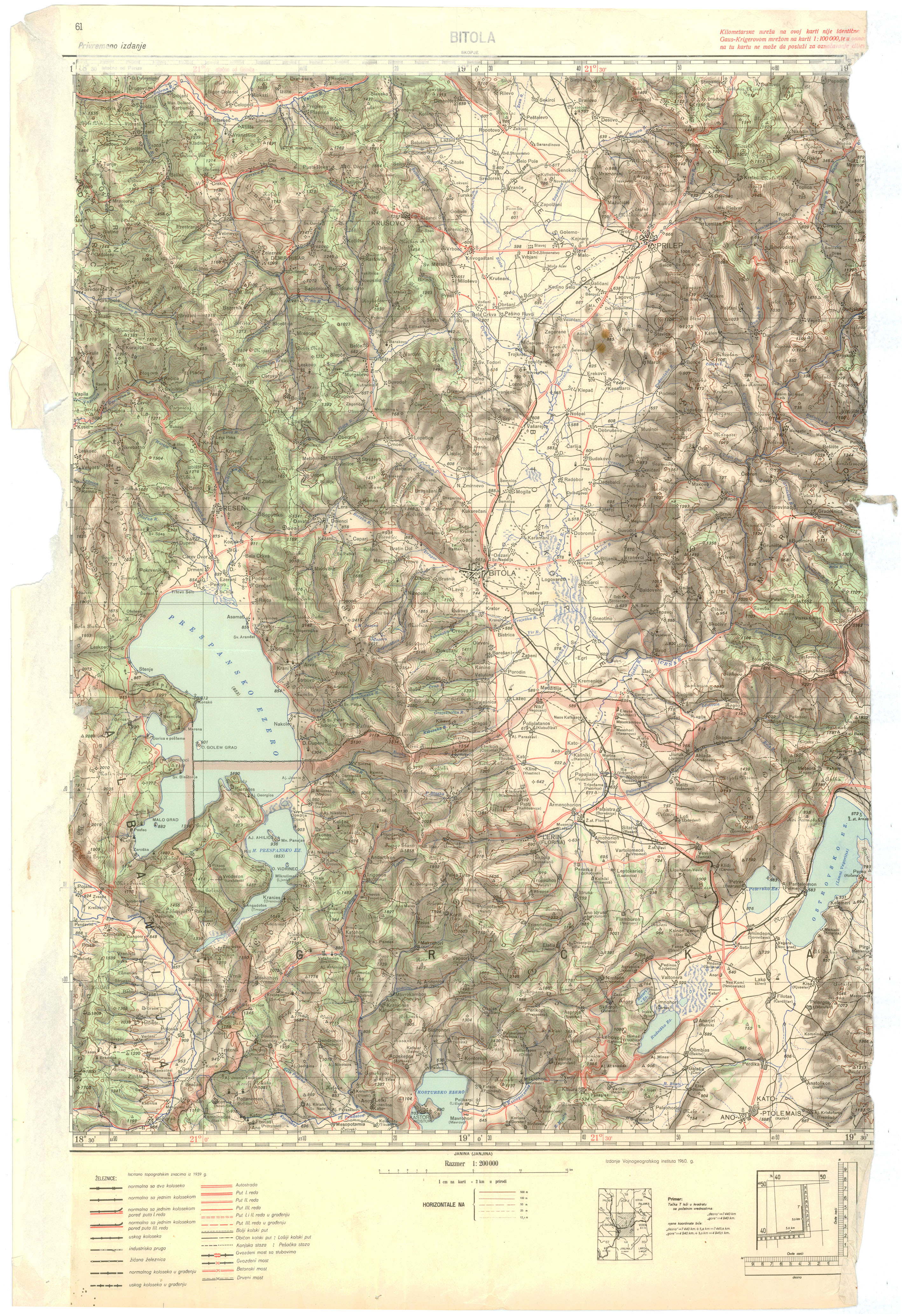
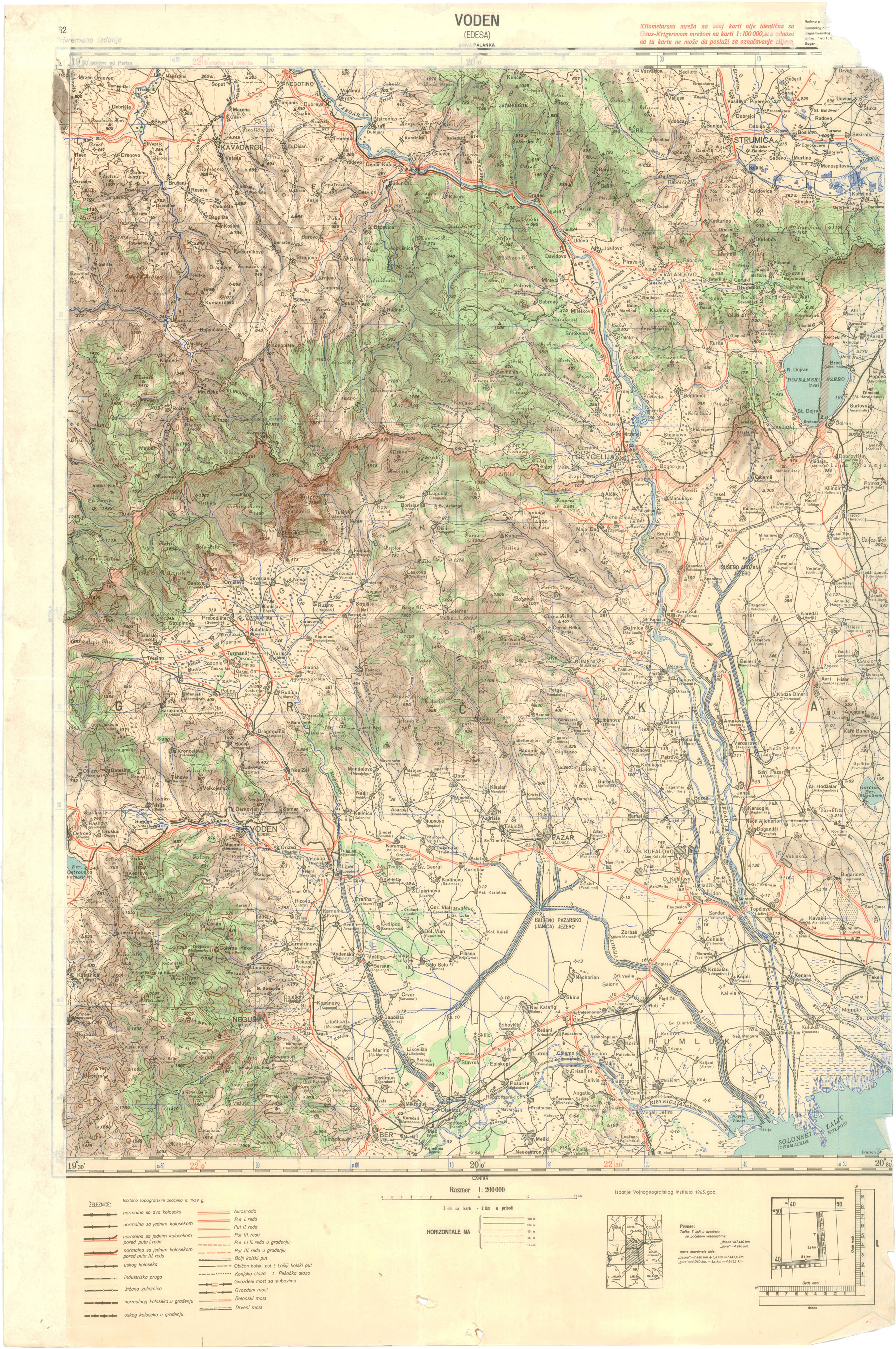
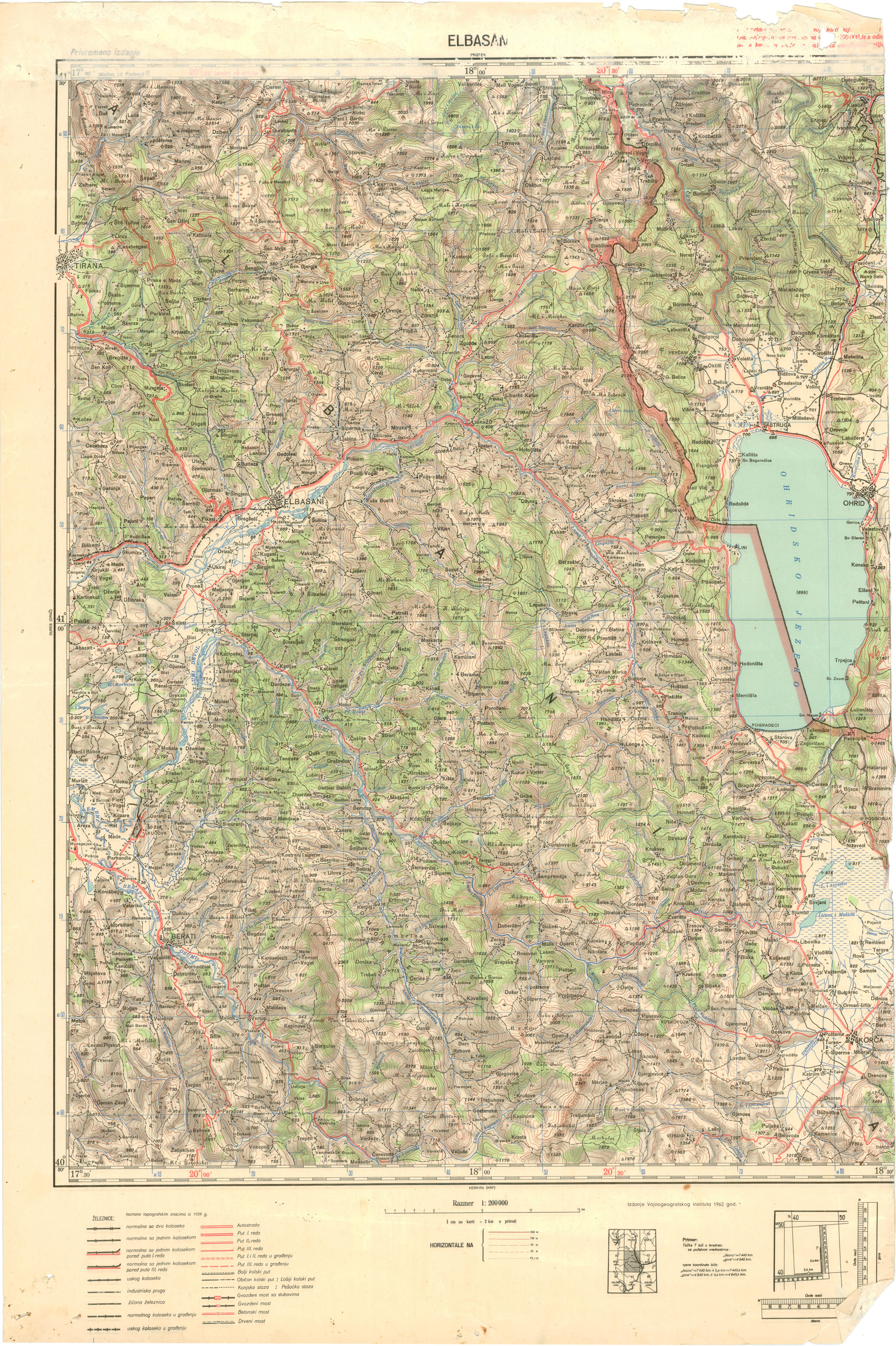
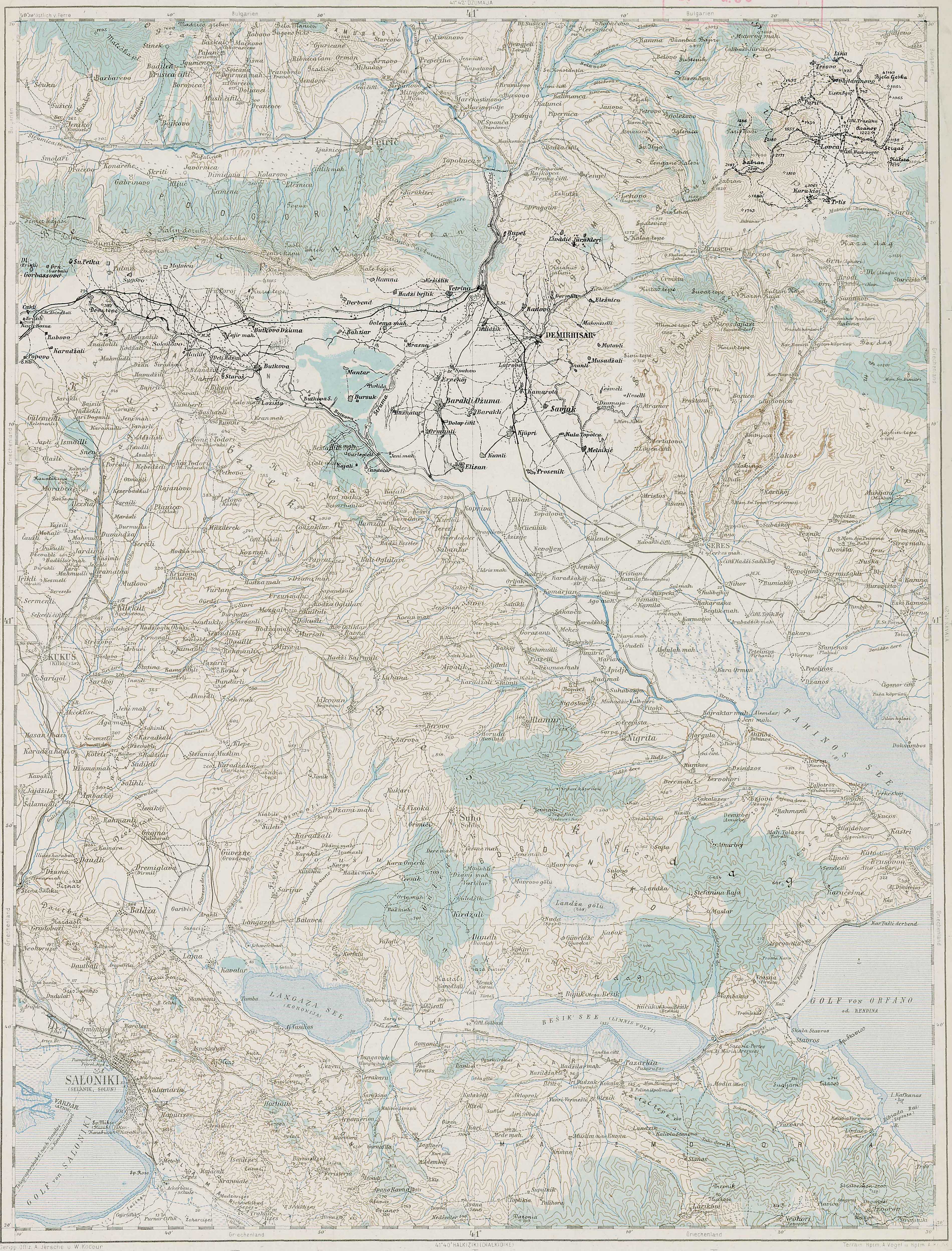
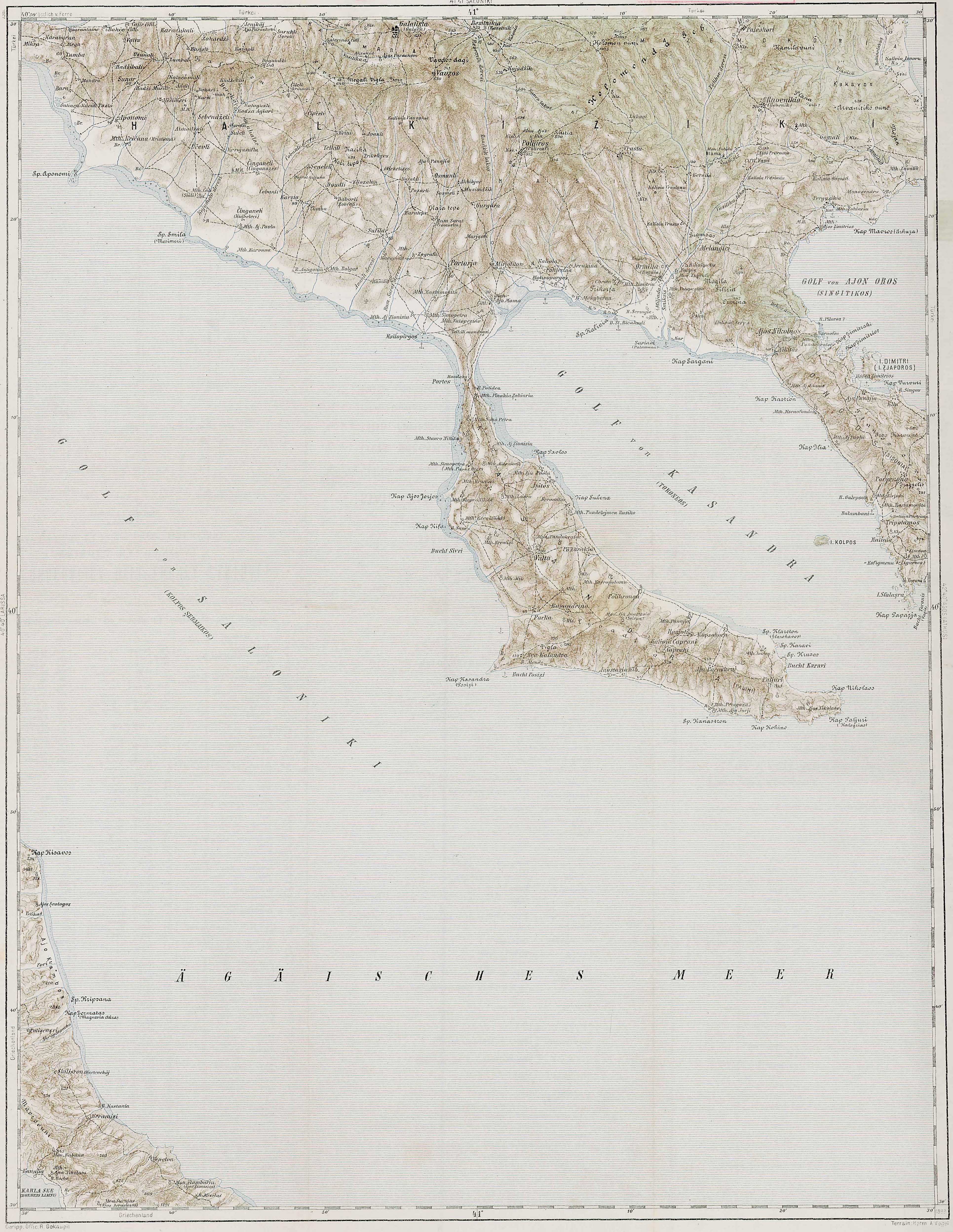
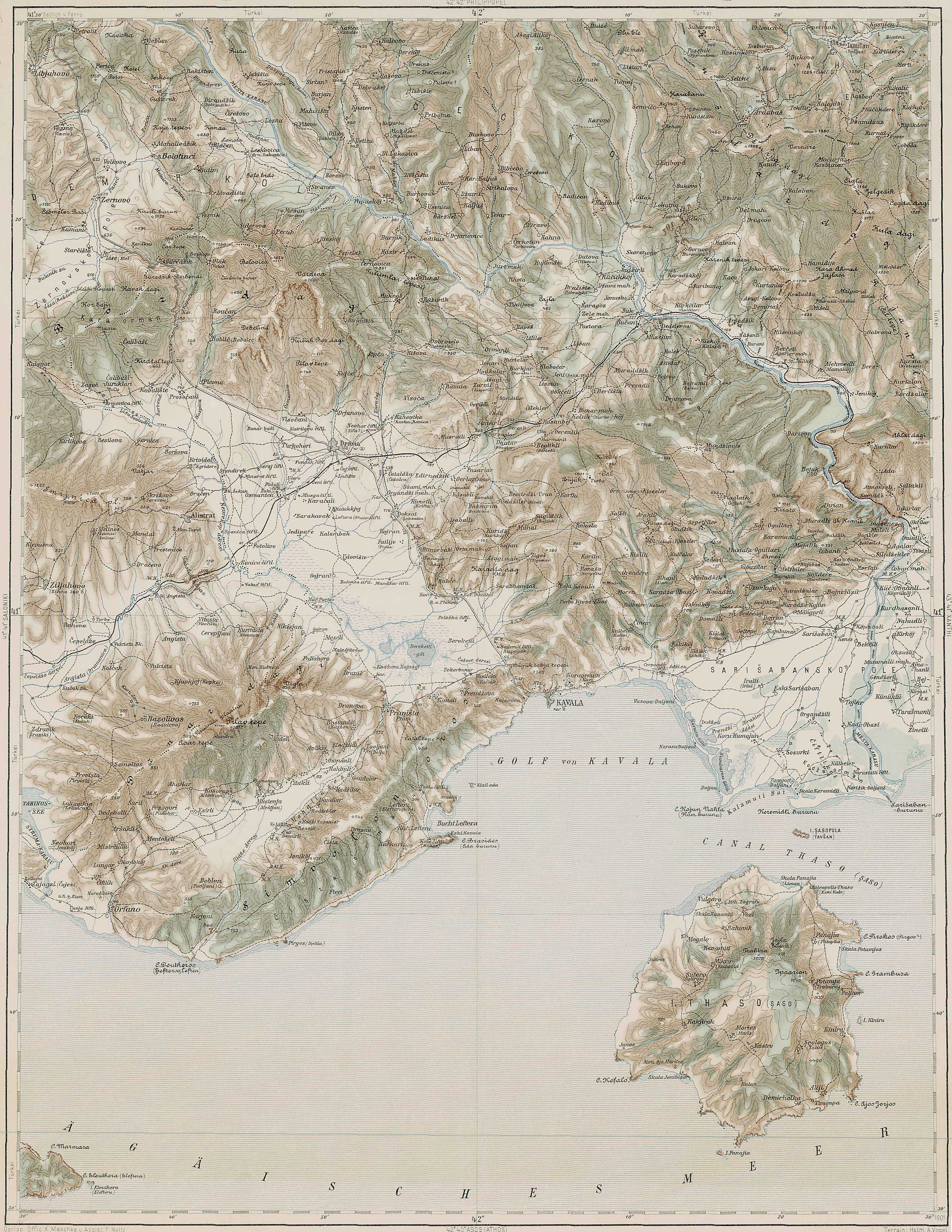
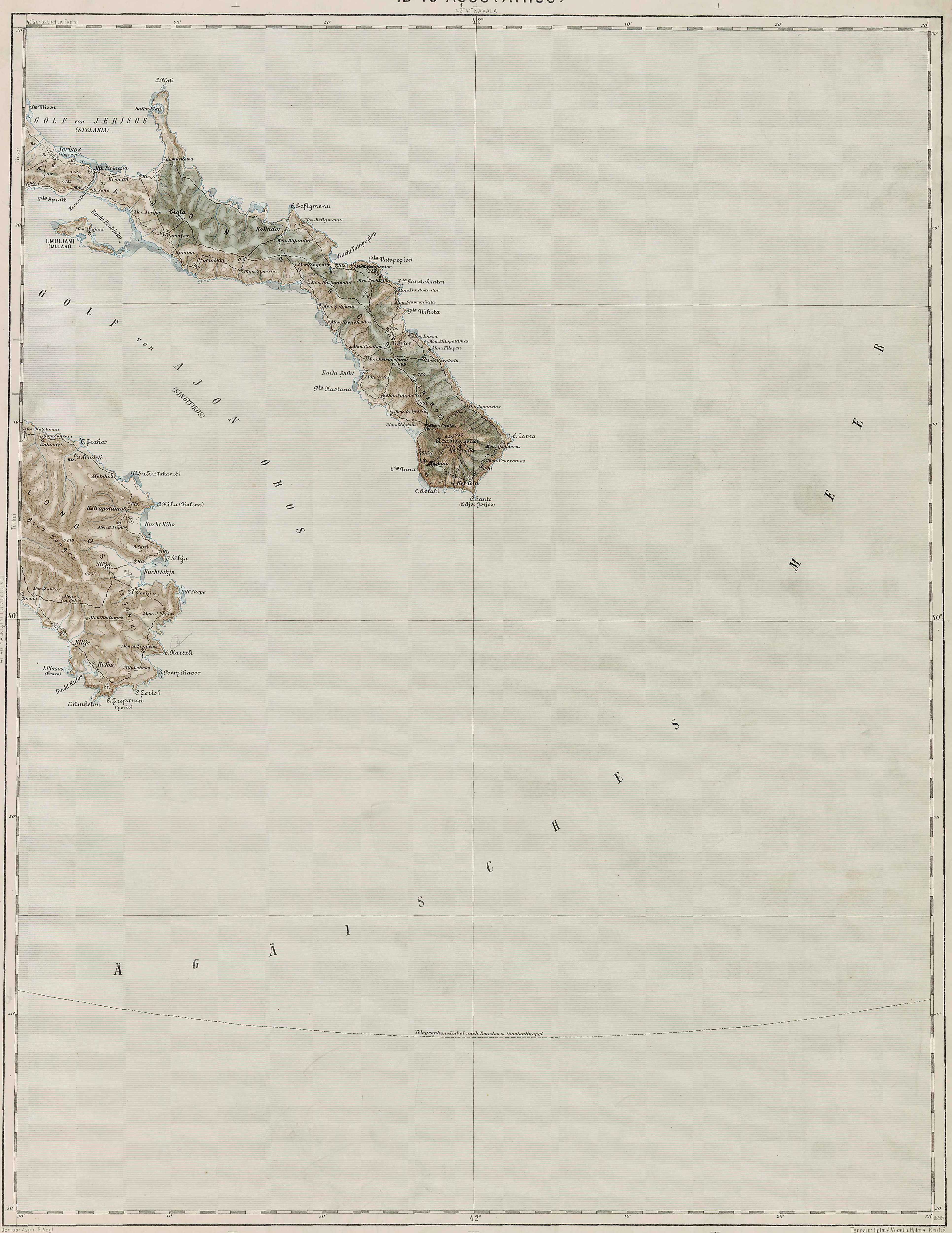
The first six maps, under Detailed Maps of Macedonia and Surrounding Regions, were published by the Vojnografski Institut (War Geographical Institute) between 1960 and 1966.
The maps are part of a larger series of maps that covers the southern Balkans, however the other maps are not available and only these six maps are able to be republished here. Please notify Pollitecon Publications if you have any further maps in this series.
The detail allows viewers to zoom in to village level without noticeable loss of quality.
The maps of northern Greece are also notable as they give towns and villages their original Macedonian names as well as the new Greek names imposed in the early 20th century when these lands came under Greek occupation.
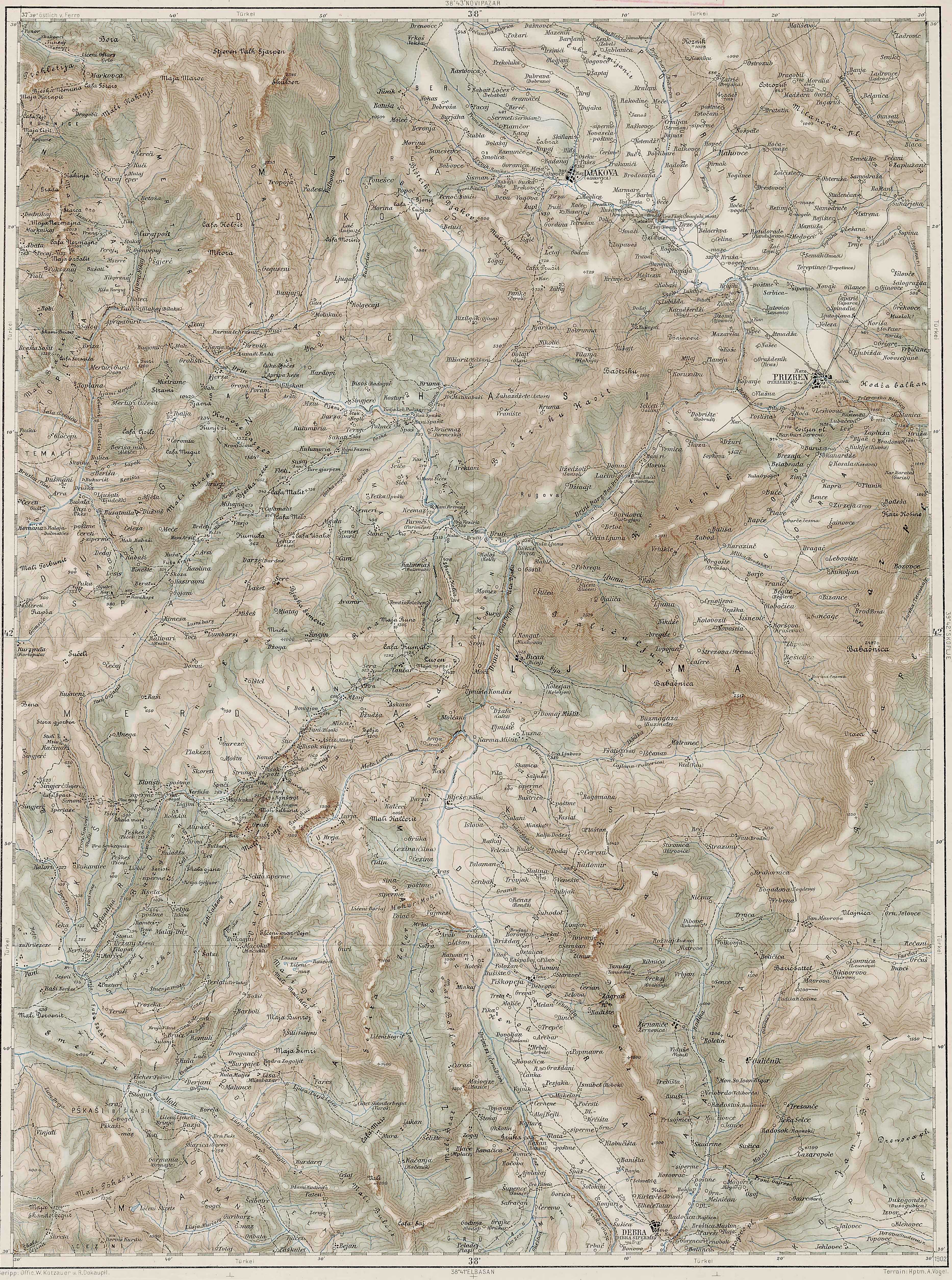
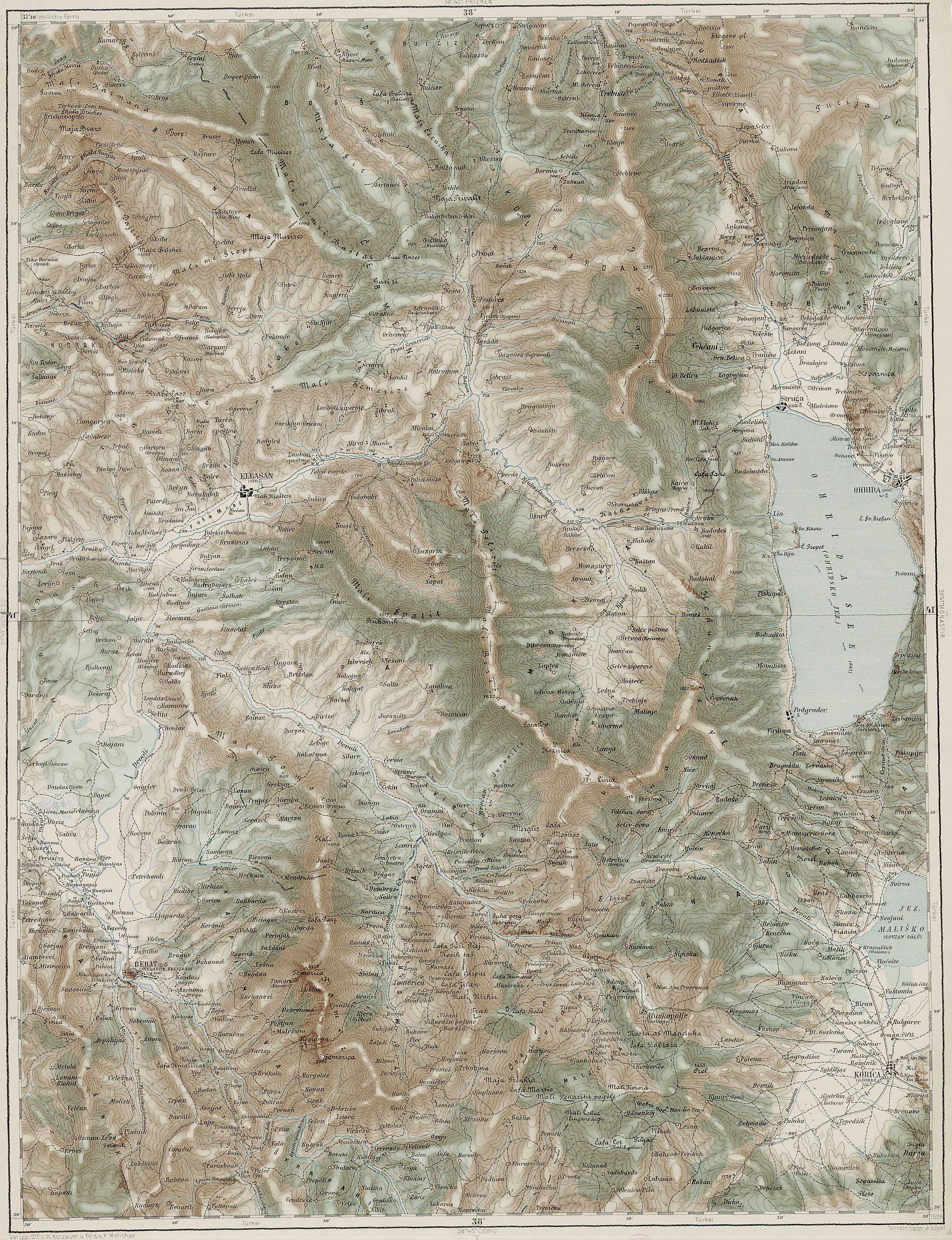
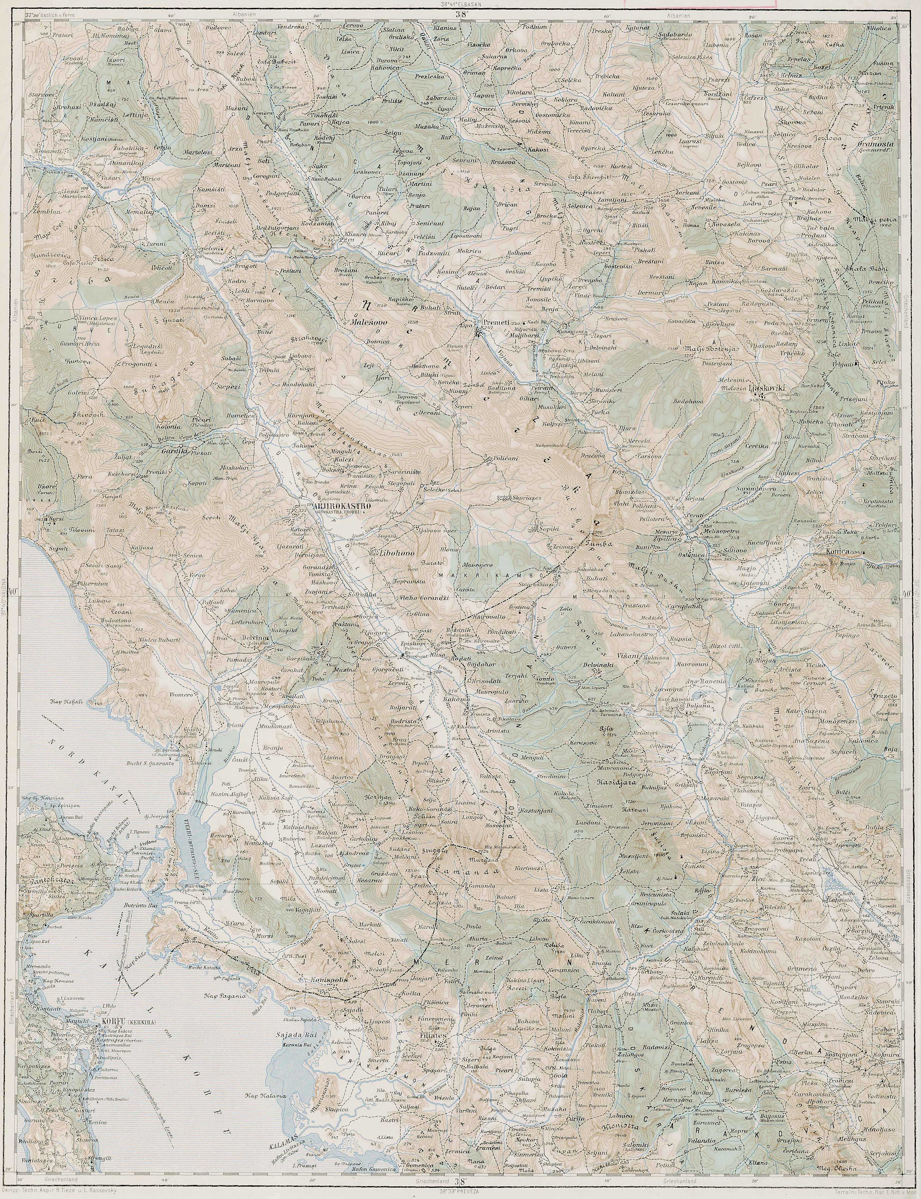
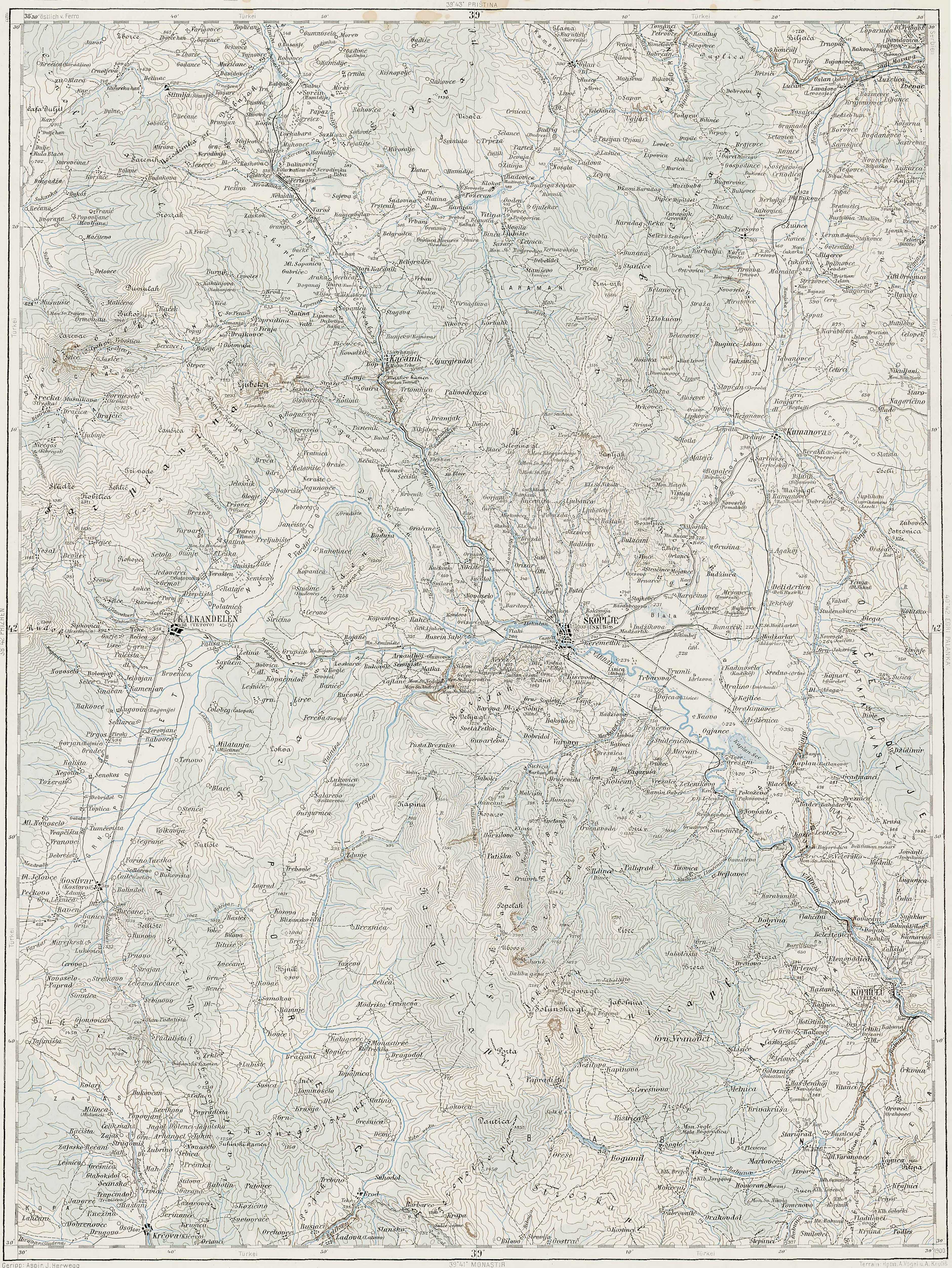
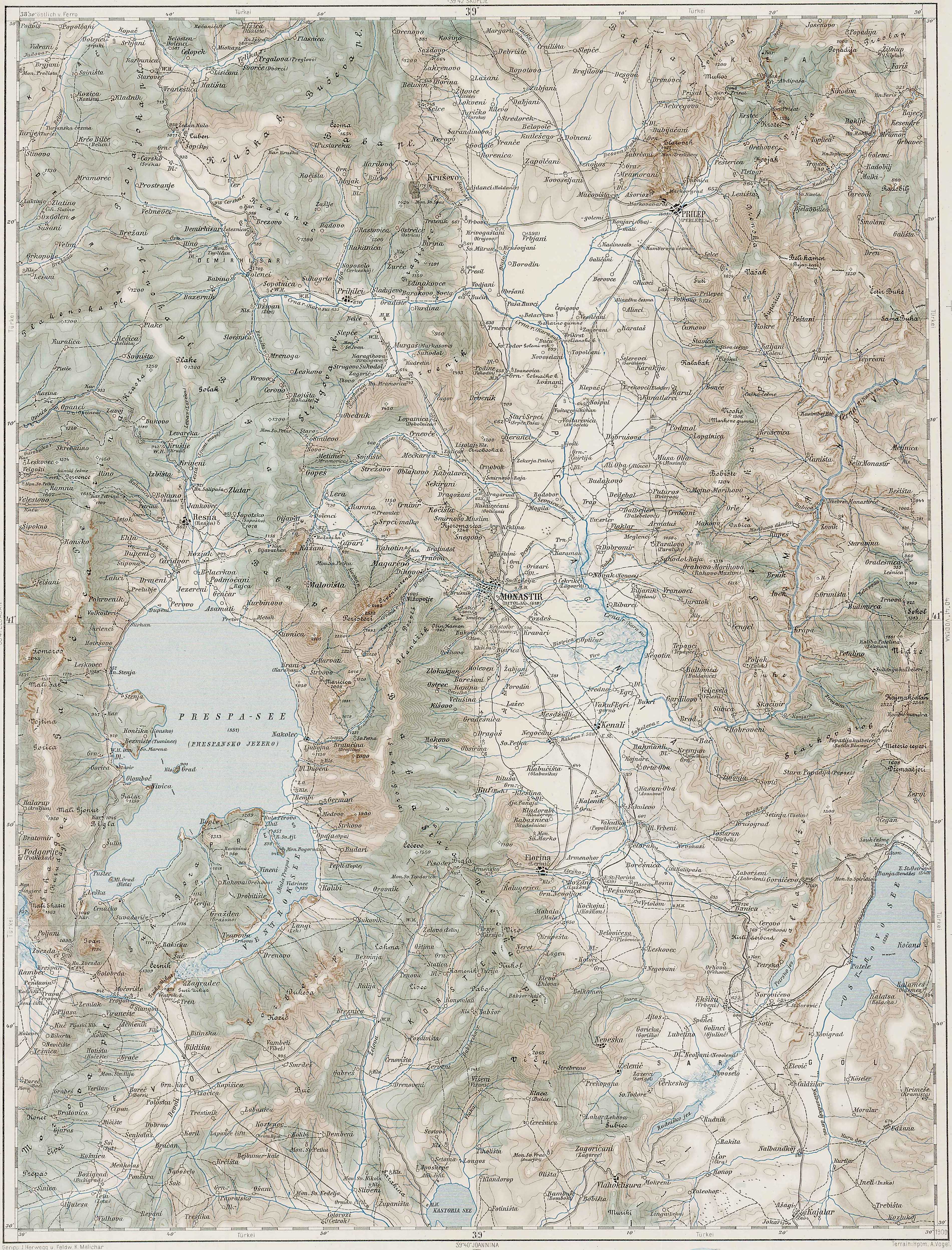
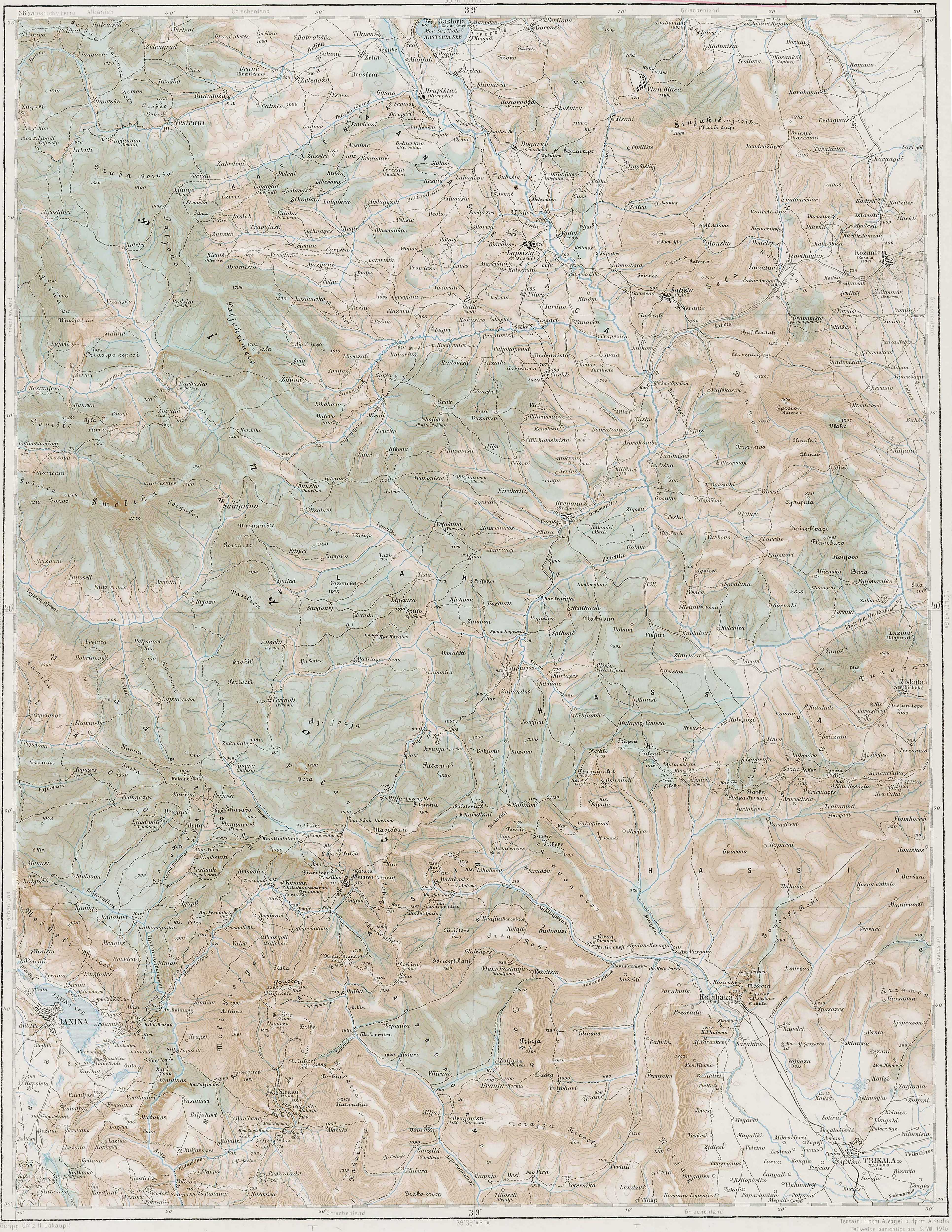
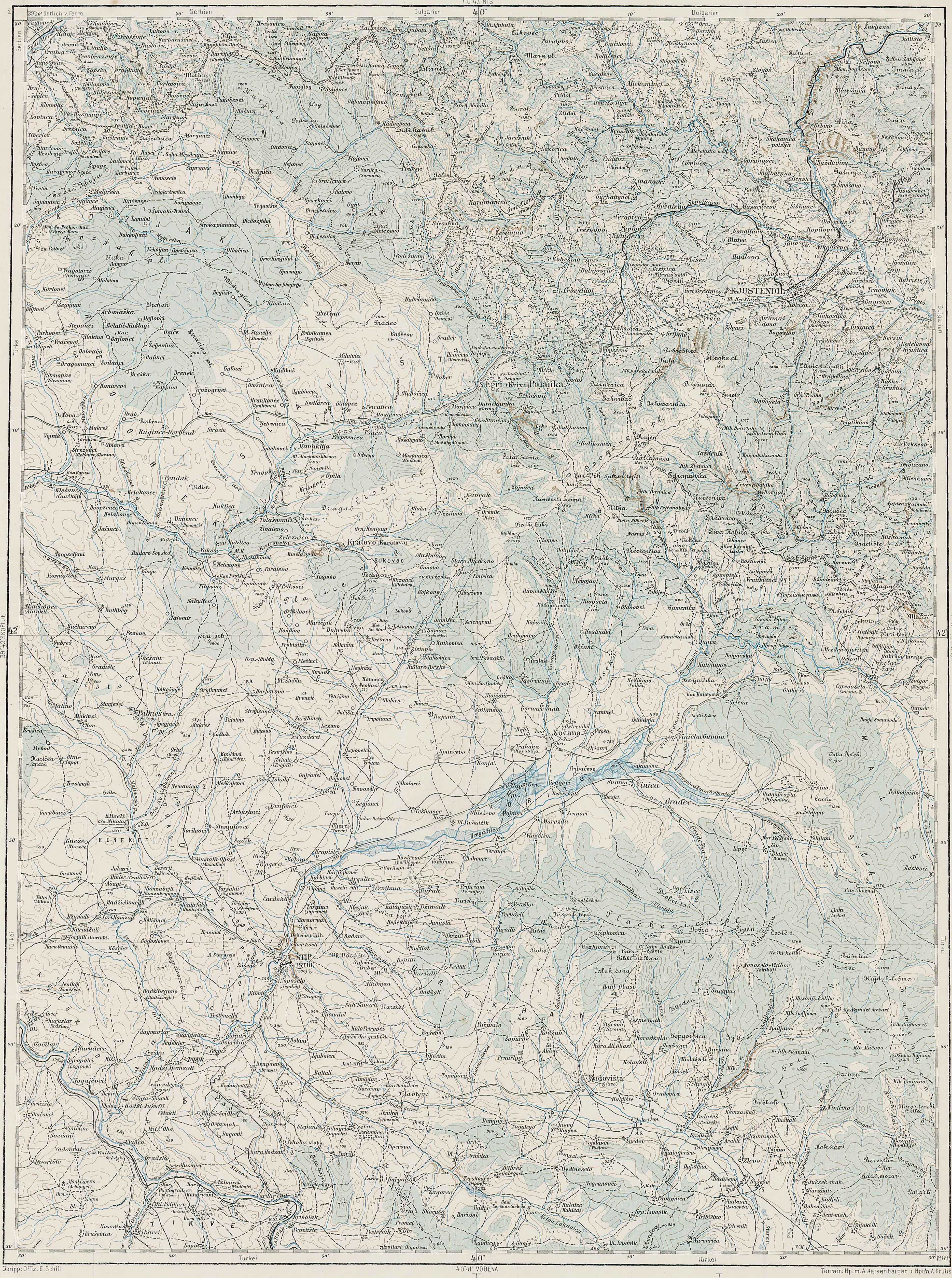
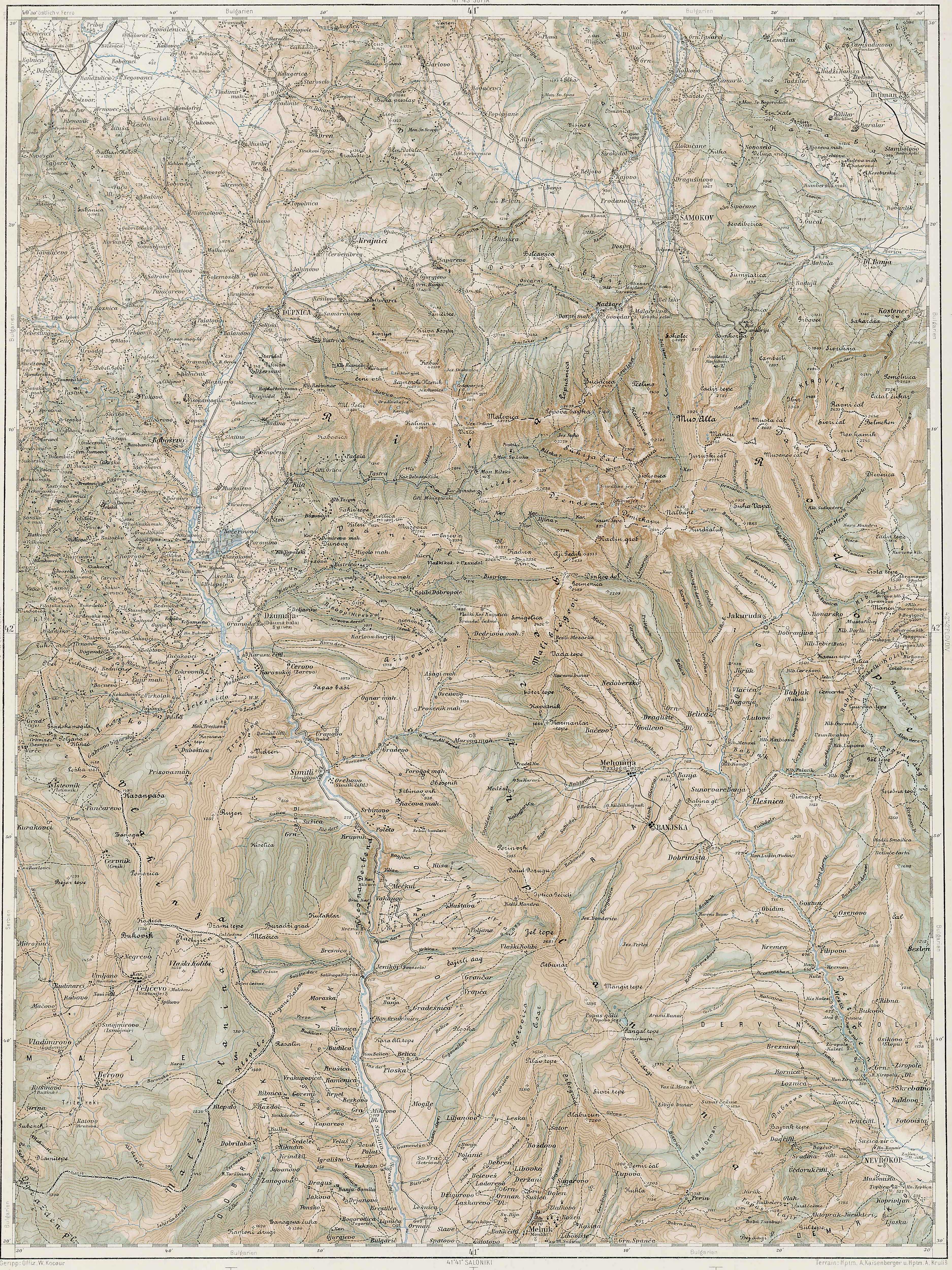
Th second set of 14 maps, under Links To Other Detailed Maps of Macedonia, was published by the Austro-Hungarian military between 1898 and 1904. The first link is to the main map of central Europe and the others are links to the specific and detailed maps of Macedonia and surrounds.
Detailed Maps of Macedonia and Surrounding Regions
Links To Other Detailed Maps of Macedonia
3rd Military Mapping Survey of Austria-Hungary
| 
